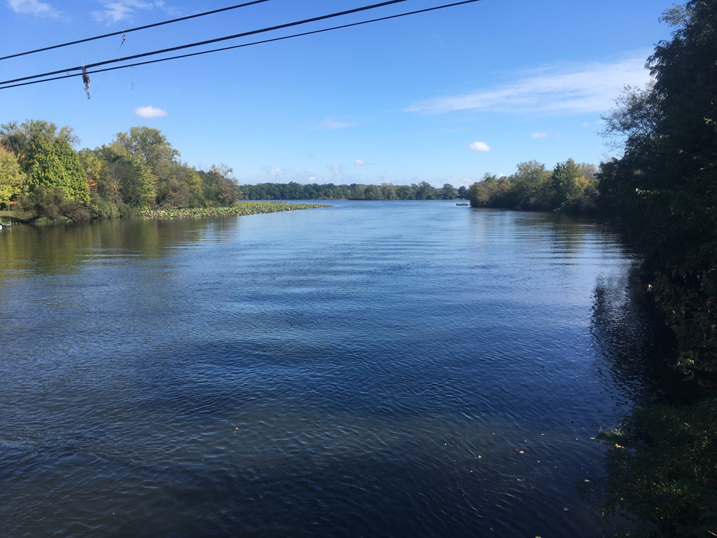
For two halves of my life now, I’ve traveled almost daily across the Huron River at Rawsonville, Michigan.
It began when I was a child, when I would often ride this road as a passenger with my father or often with both parents, to visit the K-Mart that until a couple of years ago had anchored the shopping center at the crest of the hill. It was there where I bought my cheap, K-mart-brand Instamatic film and my cheap, blank Certron cassette tapes, and whatever else appealed to a grade-school boy left to roam the aisles on a gloriously free Saturday, and could be purchased with the scant few coins in his pocket.
Yet for all of my experience as a passenger in the back seat as my father drove down this deep valley and up the other side, there was still one thing that I never noticed, even though it must have always been there.
Even as my childhood eyes were free to peer into the dark woods on either side, as they often did, to the old log cabins on the east side that I often imagined were the remnants of old Rawsonville (they were not), or to the fishermen who would usually be angling in the river from the bridge, I have no particular recollection of seeing anything in the forest to the west, but a lonely overgrown drive, gated off, that curved out of sight.
Fast forward
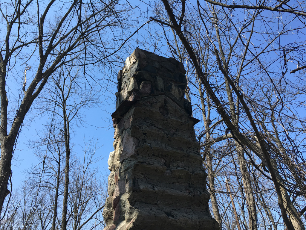
Now decades later, I had repatriated my childhood neighborhood after decades of absence, and found myself driving this route as an adult. It only took a couple of autumns to finally detect this mysterious feature that had eluded my childhood eyes. As I would drive down into the valley from either direction, if the leaves were down and the light was just right, sometimes I would glance to the west, and for a fleeting instant, I would swear that I saw some kind of dark monolith back in that woods. But I had to keep my eyes on the road. Before long, I had become quite good at timing my glance so that I could see it for longer and longer portions of that instant. Through these accumulated glances I became convinced that it was a free-standing chimney, possibly from an old house.
Now, this was interesting! Could Old Rawsonville, the so-called ghost town that we all knew about but had never seen, have a lingering remnant that no one knew about? Of course, I knew it couldn’t. But what was this thing — why was it there, and even more intriguingly, why had I never seen it as a child?
One day, in early 2017, I was having a beer with a friend in Ann Arbor, when he mentioned a concern that Rawsonville was about to be obliterated by the NEXUS pipeline, a controversial project that would carry fracked natural gas between the US and Canada. He had previously developed a bit of a fascination with Rawsonville, and before the pipeline went through, he wanted to see if he could find a trace of the mill race that must have existed when, as we both knew, a mill of some sort had existed on the river in the 1860s.
The mystery of Mill Lane
Now, we had always known that this location also included another intriguing anachronism: the nonexistent Mill Lane, which despite having been completely overgrown and blocked off even since I was a child, was still appearing consistently on Google Maps, Bing Maps, and Apple Maps, as a little road that invitingly turns off to the west and meanders for a bit along the river. I loved to bring up this little failure of modern technology, as this road was stubbornly persisting in the technology of a generation that had long since forgotten it.
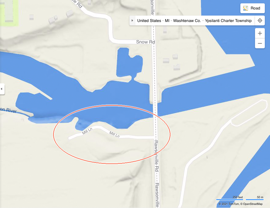
We became determined to visit, and solve these mysteries — of the mill race, the lost lane, and the chimney — all at once. We did so on the following Saturday, which promised to be a bright and brilliant spring day.
Breaching the interior
My friend picked me up and we drove to the scene. I was a bit concerned about where we might park, because it’s a high-traffic road with no parking, no shoulder, and spotty sidewalk coverage. But my carefree friend assured me that it would be no problem to just jump the curb and park on the dirt strip on the north side of the bridge, where the fishermen always park. So we did.
As we got out and crossed the bridge toward Mill Lane, it was still a bit difficult for me. As I child I had sometimes asked my father about this area of land, and he told me not to go there — presumably because it was clearly posted against trespassing. And the very same “No Trespassing” signs that were there in my childhood, now a bit antique, were still there. Something deep in my brain had to remind itself that my parents are gone, and I was a big boy now, and could assess the situation as I saw fit.
Based on my research with the Washtenaw County parcel map viewer and the Ypsilanti township parcel description database, I believe Mill Lane and a substantial width on either side of it to be public property, all the way to the river and for a similar distance inland, and hence the fishermen and I have a right to be there, and the sign at the gateway (placed by the corporate owner of the privately owned tract to the south) is meaningless.
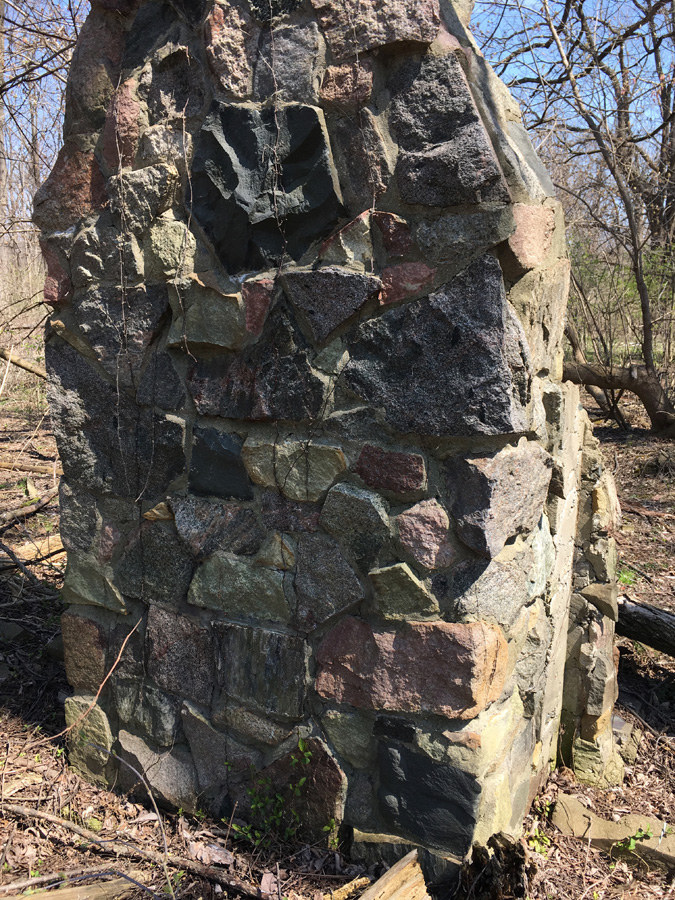
We bushwhacked through the brush and found the site. It was indeed a large, masonry chimney. Looking more closely at the indentations in the mortar, it seemed to have been the chimney and fireplace of a log cabin. Very intriguing. Was this the last remnant of an original house of Old Rawsonville?
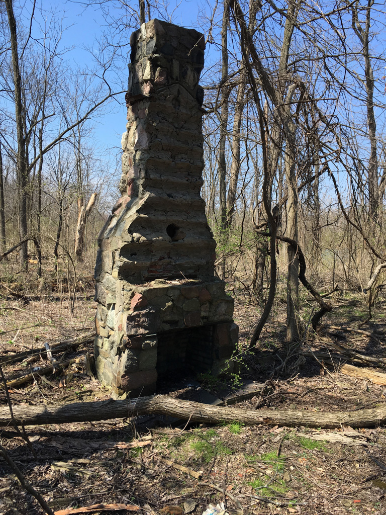
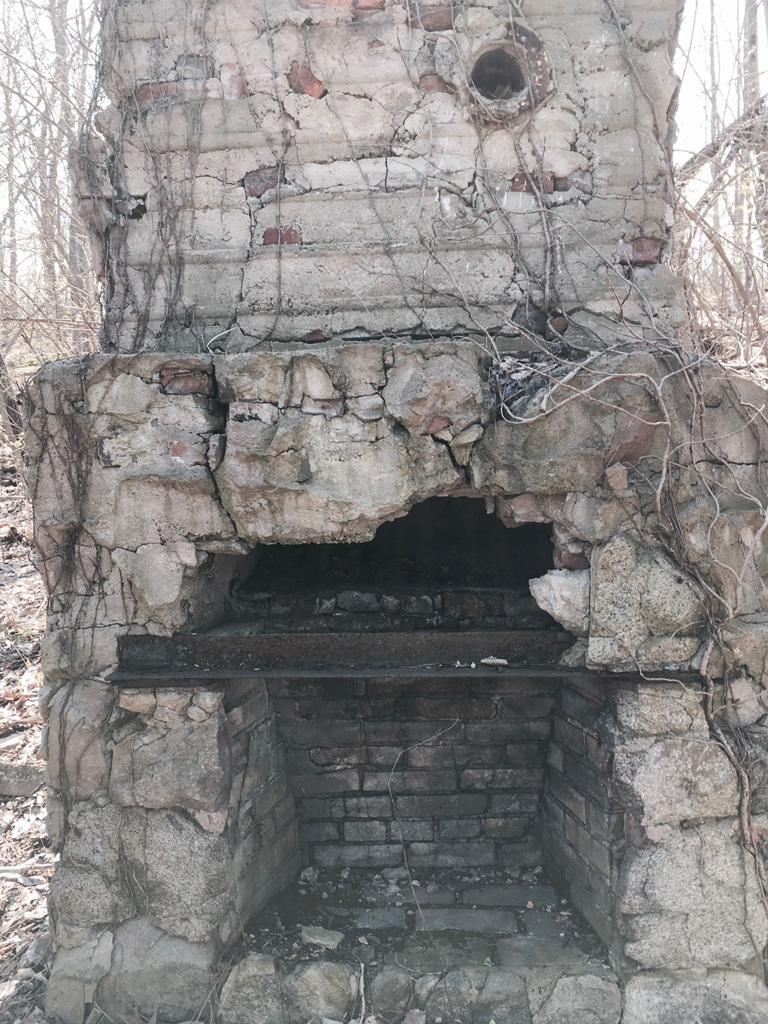
Probably not. I felt that the stones and the concrete were not 1860’s vintage. The stones were mostly angular fragments of larger quarry-type rocks, the sort that I associate with more modern construction, rather than the fieldstone that would have been more easily locally available at the time. Shipping rocks from afar was simply not an attractive option in a time and locale that did not have trucks or even rail. The mortar was hard, probably Portland cement; I would have expected a softer lime mortar. Also, there was a large steel angle-iron structural member at the front of the fireplace, which seems extravagant or perhaps impossible for a modest frontier cabin in 1860. There was also a steel peak embedded in the masonry near the top, signaling where the roof had once been. Most likely, this was twentieth century construction. My friend speculated that it might have been a hunting cabin, built by locals on what they knew to be abandoned public land. And, at some point, it burned down.
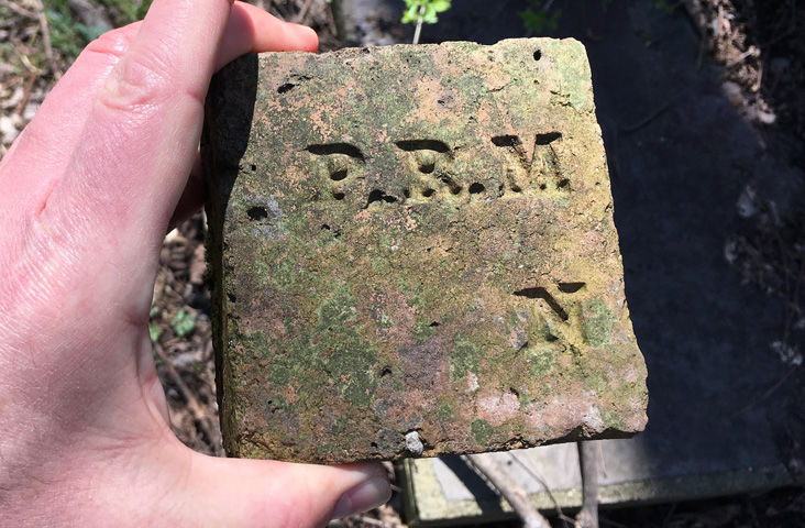
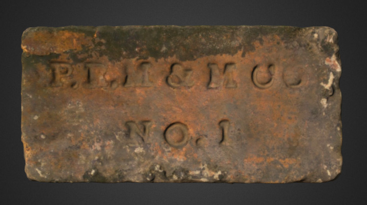
I found an intriguing bit of evidence near the base of the chimney. It was half of a very old brick, with letters on it. It’s amazing how much information a few printed letters can carry. They meant nothing to me, but the font suggested that the brick was probably 19th century. I put it back where I found it, but took a picture first, because I thought those letters deserved some research.
Further
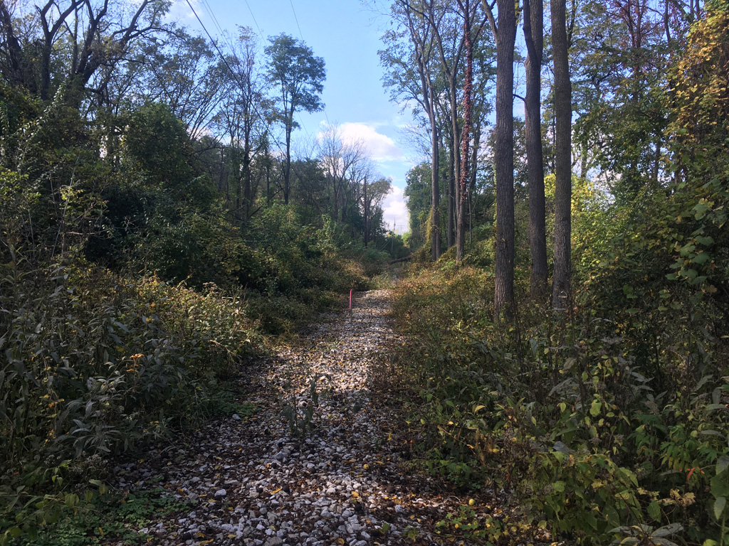
By now, we were in pretty deep. It was a perfect day in early spring, we were in an abandoned forest, and only the earliest spring ephemerals had yet emerged to block our view of the ground. We took a further walk along a faint path, the ghost of Mill Lane.
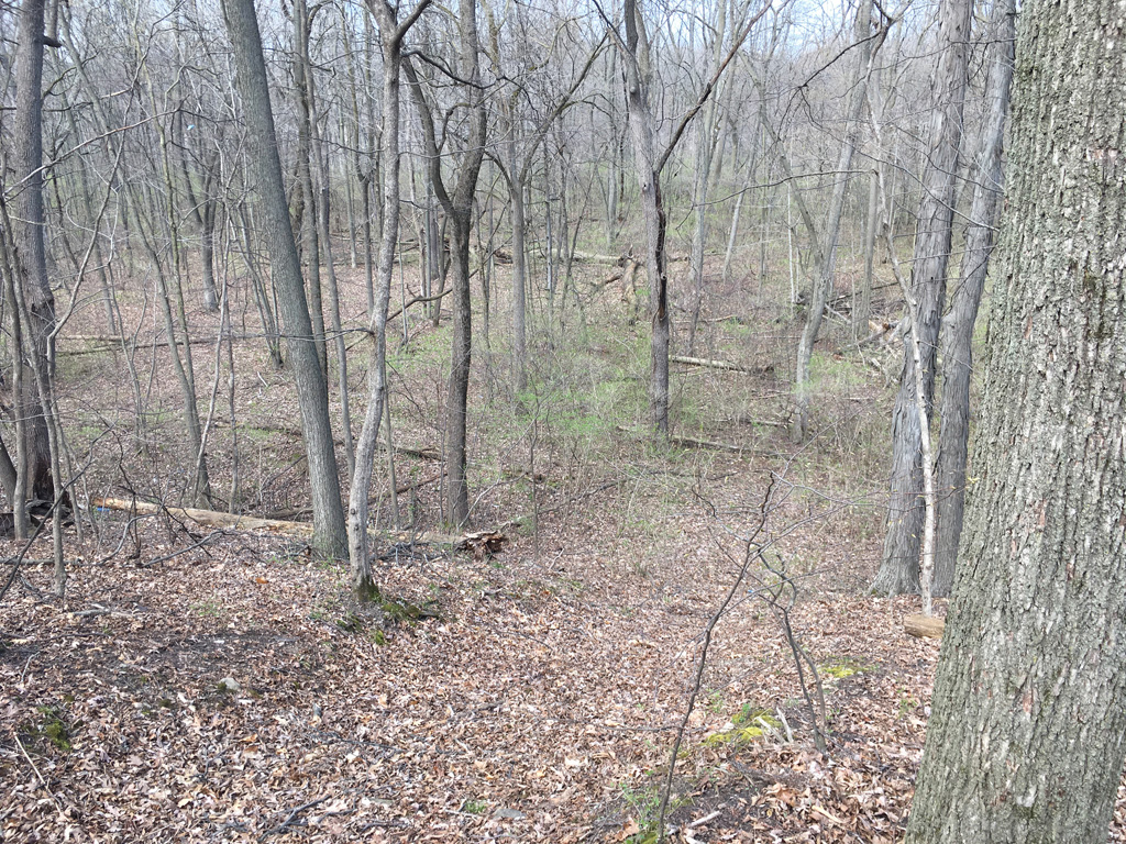
Later we found that the old drive continued on and on, quite a long way. It was impossible to tell if it was entering private land or not. There were no signs to warn us of it, as there should have been, stationed at the true boundary between what I knew to be public and what might have been private.
Down in the dumps
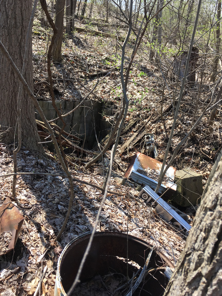
Meandering a bit down the hillside toward the river, we discovered that there had, at one time, been several other cabins or similar structures here, not far from the chimney. There were various places where mysterious walls of brick or concrete block sank into the ground, evidence of makeshift basements or foundations of possibly haphazard structures, built to give them some purchase on an unstable slope, where they may have been built without permits or opposition, on public land. The photo below shows one of these half-buried walls.
As was the custom of the mid-20th century, this lonely country path was also sometimes used as a furtive dumping ground for miscellaneous unwanted items. Here we can see remains of what looks like a 1960s household appliance of some kind, and a steel barrel. It’s hard to say if these were dumped here from outside or if they were furnishings of the old structure. Either way, they’ve been here a while.
Many of these places that have been arbitrarily closed off and posted against trespass, even this one where a gate and erroneous signs had been posted on what was actually public land, were treated that way to prevent illegal dumping. All over, there were signs of small dumping events from the 1960s or 1970s, of what I could recognize as the well-weathered remains of a trunk or tailgate’s worth of ordinary household trash or construction materials. Some looked like they might have been the leftovers from a long ago picnic, or perhaps the accumulation of repeated visits by the same person or family, or a worker taking lunch break from the Ford plant, coming back to their secret turnout on this hidden two-track.
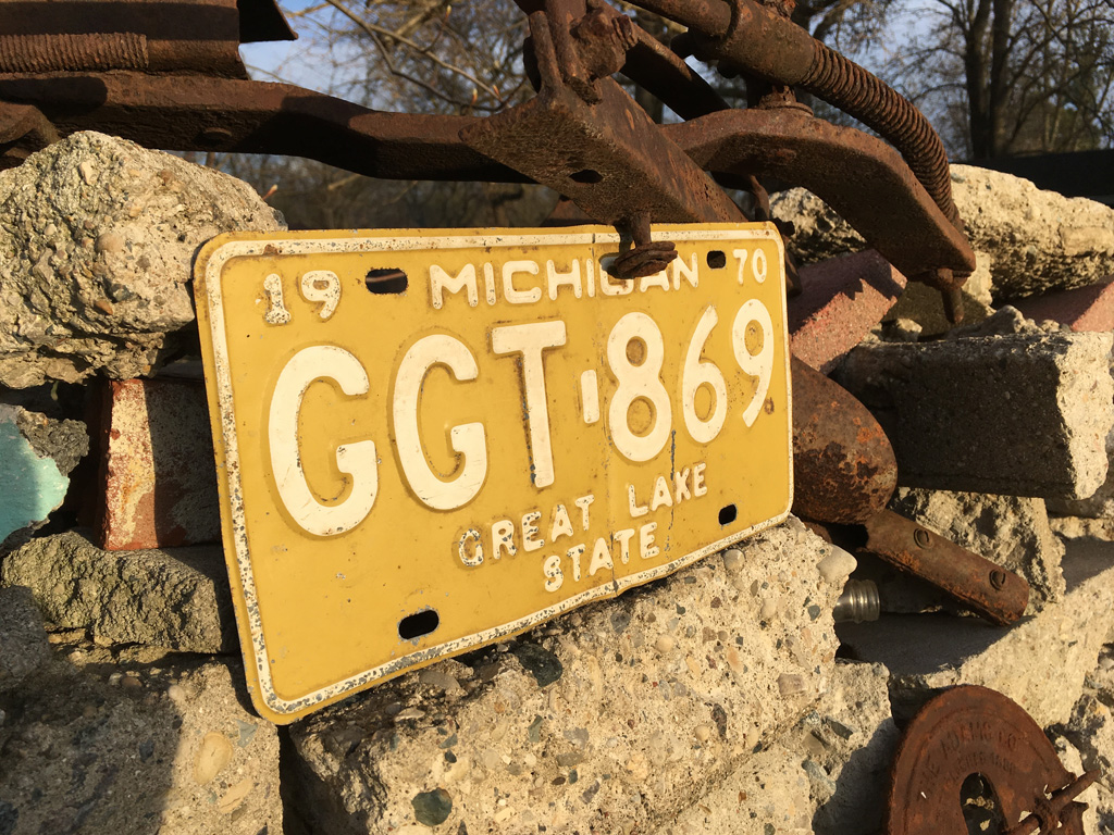
As a child I used to ramble through forgotten forests like these, searching for much older pre-1900 household dumps where farmhouses once stood, which often would yield antique cork-topped, handmade bottles of heavy, bubbled glass, which fascinated me. Often lying in plain sight amid fallen leaves or in a hedgerow, early spring with its lack of vegetation was the time to find them. This means that even today, I have a very good eye for distinguishing interesting artifacts from the forest floor, even if all the good stuff has already been found. I went home with a 1970 Michigan license plate in surprisingly good condition, and a couple of Pepsi bottles from about the same era, which are surprisingly rare today, because nobody ever saved them.
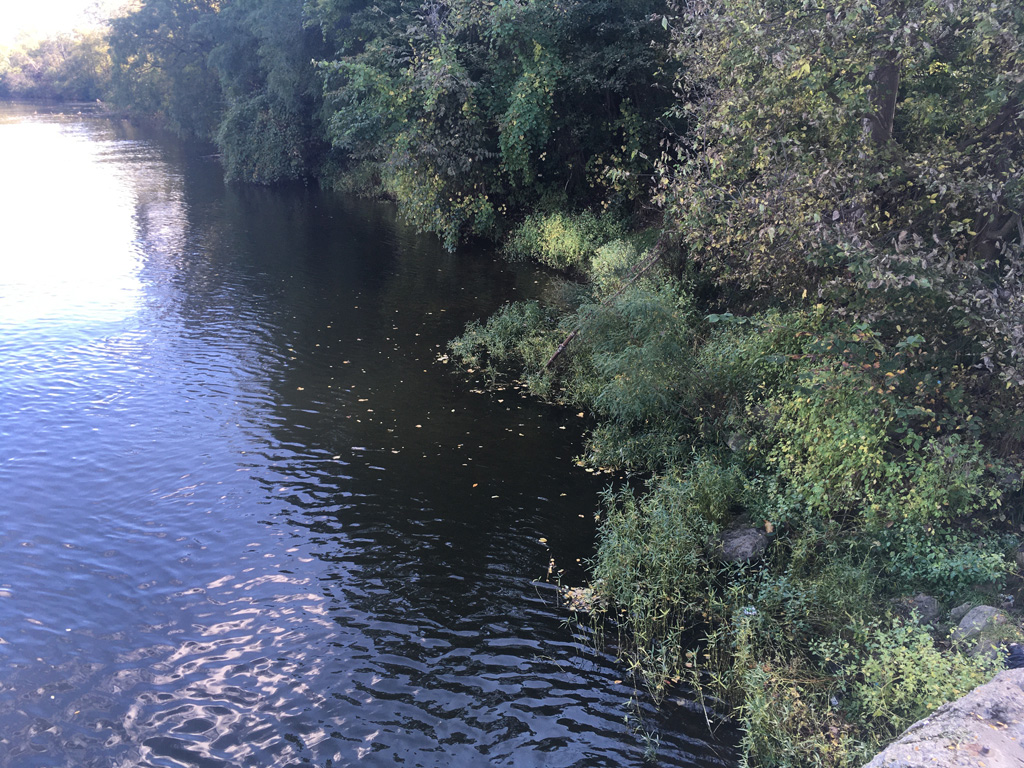
As for the mill race my friend had wanted to look for, we had earlier found evidence that the mills at Rawsonville had been powered by a dam, not a mill race that branched off the river. Thus there was probably nothing to look for. However, there was a very old, seawall-type concrete structure that could have been the base for a dock, on the bank at the southwest side of the bridge. The river bed has likely changed its configuration over the years, with the construction of Belleville Lake and the Rawsonville Bridge. I would speculate, based on old maps, that the river was lower and separated into one or two rivulets that were easier to dam with 1850s frontier technology than the wide, deep river we see today. Some of these maps can be found in my other article about the so-called ghost town of Rawsonville.
Act 2: The brick
A few seasons later, it had turned out that the Nexus pipeline did not go through this area, after all. The destruction was further to the west of Rawsonville. The chimney was still there. However, before too much longer, the large corporate property to the south was put up for sale, and by summer of 2021 there had been some surveying activity at Mill Lane.
So I became determined to return to the site, because I was worried that it would soon become a tract of McMansions, and I still wanted to research that brick. I wanted to find the other half, so I could read the rest of the letters.
But I did not have my happy-go-lucky friend to drive me there. I decided that I would park in a shopping center up the hill and walk in on foot, following the sidewalk that existed along one side of the highway.
On this second, solo excursion, I knew that I was on a mission that most would not understand. Although I relish such adventures, it is in my personality to feel just a bit self-conscious about indulging my interest in them. For one, I know that owners of shopping centers often don’t like it when people park there and then walk off the premises without actually shopping. But I didn’t see any tow-away signs.
As I left the car, I felt myself cycling through a spectrum of plausible identities that might account for my presence to an onlooker. As I exited the car, I was merely an ordinary shopper; when I walked across the lot rather than entering the nearest store, I could still be explained as a shopper who had parked in the wrong place. When I left the lot entirely, no one who saw me leave the car would have seen me do so; so I simply became a local, merely crossing the street. When I proceeded down the desolate sidewalk toward the river, I could still be explained as a nearby resident taking his daily exercise.
But when I paused at the bridge, to take a few pictures, I began to border on unexplainable. Thousands of drivers prove by example each day that this is not a place to behold, but a place to be driven past, rapidly. Almost no one walks this path beside this busy and obnoxiously noisy highway; certainly no one takes pictures of the bridge, or the river, merely to admire their beauty; and I was not carrying a fishing pole. When I finally found a pause in the traffic and began to cross the five-lane highway toward my ghostly destination, I became not only unexplainable but distinctly subversive. I felt a tangible feeling of conspicuousness, alleviated only by the relative lack of witnesses that the gap in traffic had arranged.
Now, I was indeed that person who the naturalist Horace Kephart, the dean of solo camping, was talking about in the 1920s when he described what was commonly thought of those who choose to visit the unvisited wilderness, against prevailing popular practices, alone: “He who does so is certainly an eccentric, probably a misanthrope, possibly a fugitive from justice, or, likely enough, some moonstruck fellow whom the authorities would do well to follow up and watch.”
Reunited
At the chimney, I was able to find the brick again, as well as what looked like its other half, lying nearby. I also became confident, based on the survey markers that were now marking the center of the lane, that the chimney was on public ground. In fear that the property would soon be sold and the site demolished nonetheless, I made the difficult decision to temporarily remove the two halves of the brick from where they had lain for generations, to arrange for them some redemption from this forgotten and unappreciated place.
This meant carrying them for a half-mile back to the car. As I walked back out of the valley, on the seldom traveled sidewalk, I no longer could avail myself of the shifting explicatory identities I had passed through on the way down; with two half-bricks in hand, both still visibly dirty and damp from the forest floor, I was now an eccentric, all the way — I could no longer be accounted for as a local on an innocent walk, but an outsider on a mission. Who is that man? Why is he carrying two dark, damp bricks? Where did he get them? What is he going to do with them? Probably two hundred cars could have delivered these questions, if their drivers had been looking. Of course, I knew that most of the motorists passing by, even though they might subconsciously glance over at the unusual sight of a pedestrian, were as oblivious to me as we were anonymous to each other. On a highway, nobody cares, for long, about what they might be seeing on the side of the road; a vaguely unusual sight at 50 mph rarely triggers more than a half-formed thought, that will dissipate at the next traffic light. I made it back to the car.
As it turns out, the two half-bricks that I retrieved could not be joined back together any better than the two episodes of my life here — they were from two different bricks. Worse, the part that would have revealed the missing lettering was covered with unusually tenacious cement.
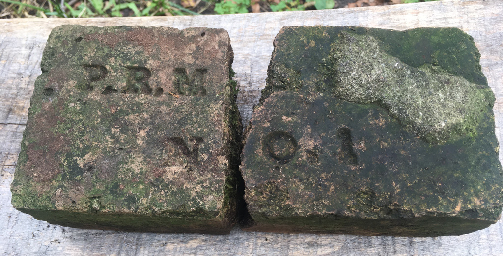
But I did not need the other half of the brick to identify the manufacturer. A web search for “P.R.M” (note the lacking period after the end) and some bricky keywords was enough to find that it was manufactured by Parker-Russell Mining and Manufacturing Company, a St. Louis brick maker, that operated from about 1860 perhaps into the 1900s. And just when you think you have discovered something obscure, you find that someone has already made a 3-d model of one. But the modeled one, and some others I saw online, seem to have embossed lettering, rather than the incused lettering of mine. Or else it’s a trick of the lighting.
It remains to be seen what will happen to the marvelous 106-acre tract of riverfront land that adjoins the publicly owned strip of Mill Lane. The “For Sale” sign is now down, and Mill Lane has been cleared and covered with a layer of crushed rock. On the river side of the lane (to the right in the picture below), the trees have all been tagged with circular metal tags, like you sometimes see in city parks. This might be an encouraging sign — it suggests that some public entity is asserting its stewardship of this riparian area, at least. But for the rest of it, well, I worry it’s going to be, “make way for McMansions” — extractive capitalism at its insidious and short-sighted best.
Update: February-March 2022
NOTE: after the update below was written, it was announced that the 106-acre tract had been targeted by Amazon Corporation, with plans to raze the forest for another distribution center. In another article, Last Exit to Rawsonville, I commented on this development. However, in August 2022, Amazon abandoned the project — which means the property is no longer under imminent threat, although the property is still for sale.
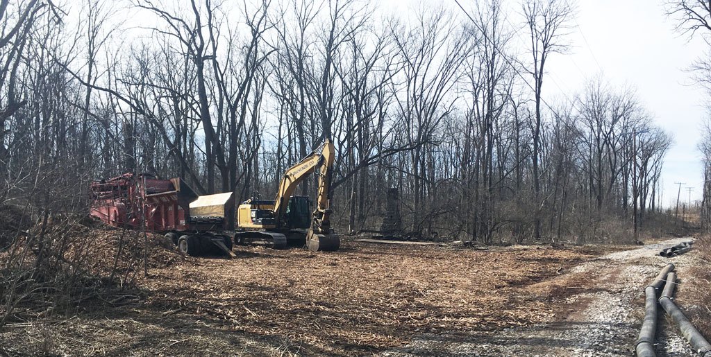
In February of 2022, I noticed additional activity at Mill Lane. Each afternoon, two large red trucks were parked on the lane, and temporary traffic signs had been posted on the main road, saying “Trucks Entering Roadway” and “Reduced Speed Zone Ahead”. Could this be the onslaught of the dreaded McMansions?
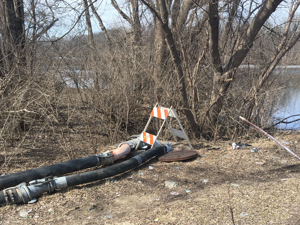
Soon, dozens of large steel pipes had been laid down along the lane, leading to some destination out of sight. Soon after, in the evenings, the destination revealed itself via a very bright construction light that appeared on a small bluff several hundred yards down the lane, near the south bank of the river. Soon after that, another light appeared on the north side of the river, at about the same distance from the main road.
The appearance of the second light indicated that whatever was going on probably did not involve the large tract of land to the south, but the publicly owned riparian area along each side of the river. These areas seem to be administered by the Ypsilanti Community Utilities Authority, which provides water and watewater service to this part of Washtenaw County.
Some research indicates that this riverside area at Rawsonville Road, Snow Road and Mill Lane includes a problematic sewer system that has overflowed into the river several times in the last few years. In February, part of the sewer line collapsed near the Snow Road pump station at the north side of the river, leading to a large sinkhole and failure of the pump station. This was probably the explanation for the activity.
Thus, on March 4, I set out on an excursion to investigate the site.
All of the activity was on the north side of the river, leaving me free to investigate Mill Lane. As seen below, the entry to the lane had now been partially cleared, the trees and brush that had previously hindered my investigation of the chimney now reduced to billions of fragrant wood chips carpeting the former forest floor. The chimney was still there, strangely exposed like an unexpected relic that no one was quite sure what to do about. There were no other clues to suggest the purpose or future extent of the clearing. To the right, a line of steel pipes are staged, presumably toward a pump station.
Near the bridge, some of the pipes had been loosely connected, and led into a sewer access hole that was partially open, releasing an odor into the air. There would probably be no fishermen lingering at this fishing hole today. I could hear the sound of flowing effluent, although it did not seem that any pumping was taking place at the moment.
I am a bit conflicted about what this activity means for this area. Certainly, it’s best not to have Ypsilanti’s raw sewage periodically overflowing into the river, and I am also relieved that the activity does not seem to be related to any future housing project. At the moment, the large tract still seems to be owned by the railroad.
On the other hand, the chimney has now lost much of its mysterious allure. When it was cloaked by a generation’s growth of shrubby sumacs and wild grape vines, it was a surprising and curious presence that, whether studied closely by a nearby fisherman or fleetingly by the driver of a speeding car on the highway, invited us to take a detour from our habitual thought patterns to speculate on its presence, its meaning, and its history. Now, as it stands at the edge of a construction site, looming over the obligatory pile of wood chips, it’s just another construction obstacle — lacking the specific historical value that might keep it out of a landfill. I don’t expect the YCUA to feel any particular reverence for such a thing. After all, the site of the old Rawsonville Inn, on the north side of the river next to the main road, was excavated to become a lagoon — for what reason I can only guess. It’s owned by them as well.
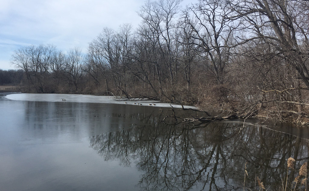
But this area still provides a beautiful glimpse of the Huron River, and hosts a number of favorite fishing spots whose users are at least not harassed by “No Fishing” signs.
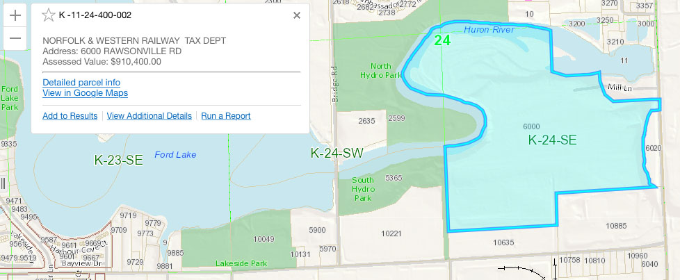
Most of the land surrounding the river is owned by Ypsilanti Township or YCUA, and so presumably is not in danger of being developed. The 108-acre tract owned by the railroad, highlighted in blue below, is the precarious exception.
Hey Ypsilanti, or Washtenaw County, why not add this tract to Hydro Park, and create a world-class riverfront wilderness park?
Article and photos Copyright 2021-2022.


9 Comments
Pingback:
Mike
I have some cool photos of Rawsonville I want to share with you. I tried sending a email to edior@whatshallweweird.com but the message was returned.
Mike
That would be awesome, Mike! The email should work, looks like there was a typo in the address, try ‘editor’. Thanks!
Paul Steen
I enjoy your history blogs about life near the Huron River. Thanks!
Andrea
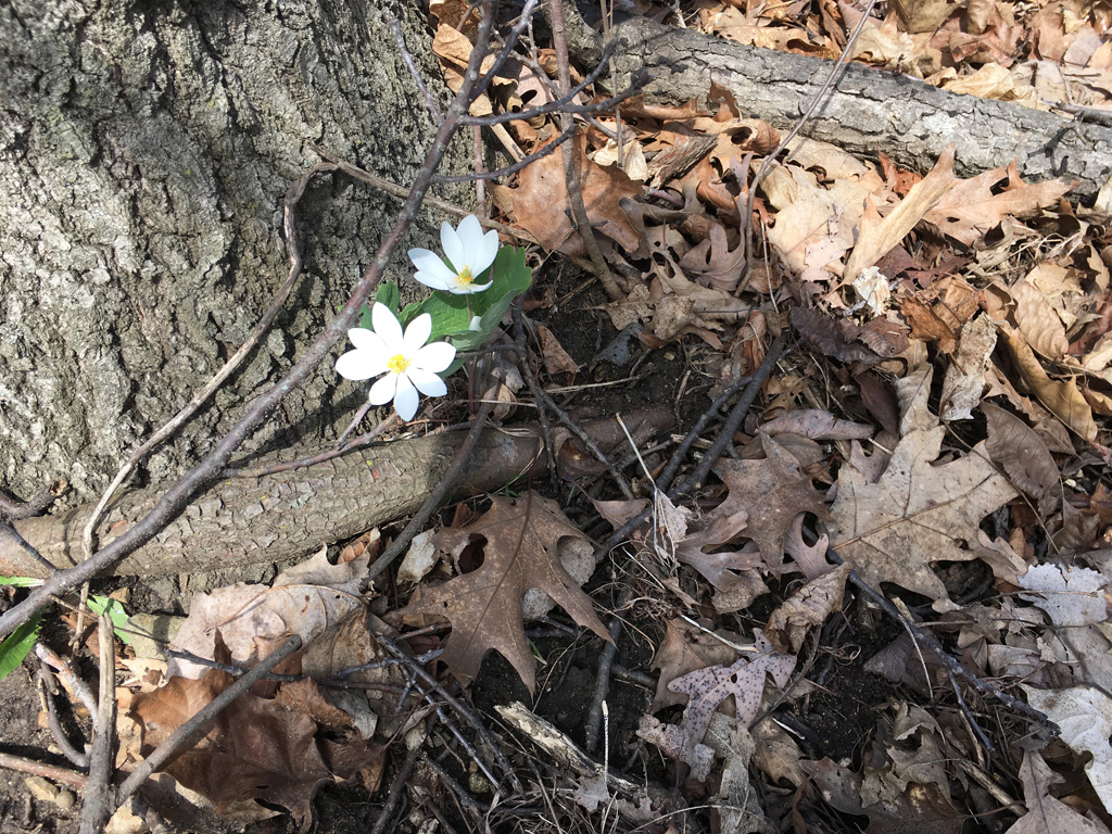
During the pandemic, my son and I were birdwatching in South Hydro Park and walked from there along the river to what I now know (thanks to this post!) is the intersection of Mill Lane and Rawsonville Rd. We saw the chimney and wondered about it. When we were there in (I think) May, the ground around the chimney was covered in blooming lily of the valley, maybe planted by whomever lived in the house once attached to the chimney? I know lily of the valley is non-native and invasive but I was still delighted. I agree it’s a beautiful stretch of land and would make a great addition to the Ypsi parks along the river.
Mike
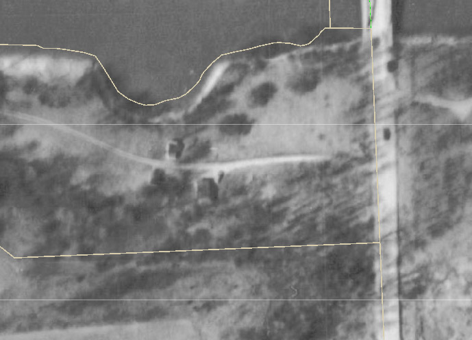
Thanks Andrea! I had no idea others had been intrepid enough to penetrate that wilderness. I was too early to see anything growing, but sometimes the only trace left of an old house is the lingering flower bed. It does appear that there was a house or something on that site in 1960:
Cindy
Mike,
Did you grow up in the area, I did for 20 years on Snow Rd., 1969-1994?
Trenton Spragg
Hey Mike my names Trenton I’m 15 and I came across milk road a little under a year ago and it’s still all there I’m going tomorrow to the chimney and digging up under where the house would have been to see if anything’s been buried so let me know if you see this
Mike
Cool, good luck!